€ 5.99 € 9.99
!!You will be able to Download the Image after payment has been made. A download link will also be sent to your email address!!
You may print this file at home or have it printed commercially for your personal use or gifting only. By purchasing this design you agree and are bound by the copyright agreement. © Copyright 2016 Eireial Creations, All Rights Reserved
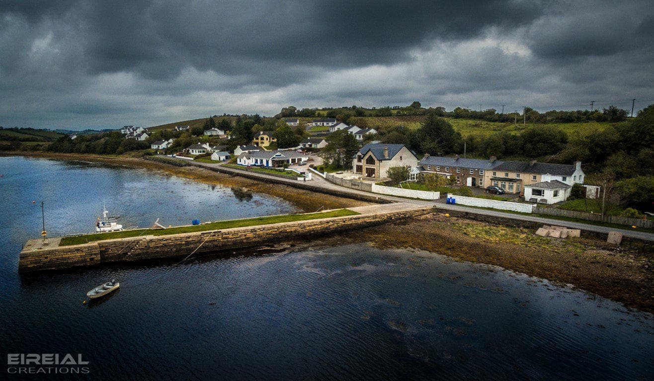
This is a shot I took of Mullinasole, County Donegal.
Mullinasole, Mullan na Saile, ie Hilltop of Salt Water, is a centuries old fishing village. It was a hamlet of twenty homesteads until it was devastated in the storm of 6th November 1831. In the wake of the storm twelve homes, the salt pans and the boats lay scattered and destroyed.
It is situated on the tidal estuary of the river Murvagh. At low water, the course of the Murvagh River is clearly seen meandering through the sloblands to enter the sea at the Hassans between Bell’s Isle and Rooney’s Island. The hamlet itself is sheltered by Murvagh Promonontory on the west, Mullinasole Hill on the south and the Rossilly Hills on the east.
€ 5.99 € 9.99
!!You will be able to Download the Image after payment has been made. A download link will also be sent to your email address!!
You may print this file at home or have it printed commercially for your personal use or gifting only. By purchasing this design you agree and are bound by the copyright agreement. © Copyright 2016 Eireial Creations, All Rights Reserved
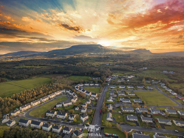
Here's another aerial shot of The Dartry Mountains near Kinlough, Leitrim.
See our License Terms here
€ 5.99 € 9.99
!!You will be able to Download the Image after payment has been made. A download link will also be sent to your email address!!
You may print this file at home or have it printed commercially for your personal use or gifting only. By purchasing this design you agree and are bound by the copyright agreement. © Copyright 2016 Eireial Creations, All Rights Reserved
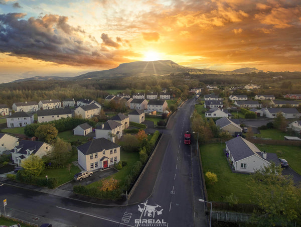
Here's an aerial shot of The Dartry Mountains near Kinlough, Leitrim..
See our License Terms here
€ 5.99 € 9.99
!!You will be able to Download the Image after payment has been made. A download link will also be sent to your email address!!
You may print this file at home or have it printed commercially for your personal use or gifting only. By purchasing this design you agree and are bound by the copyright agreement. © Copyright 2016 Eireial Creations, All Rights Reserved
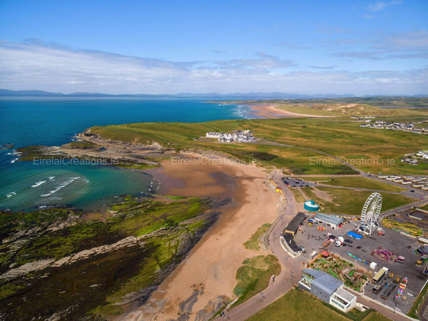
Here's an aerial shot of Bundoran and Tullan Beach.
See our License Terms here
Subscribe to our newsletter and always be the first to hear about what is happening.
© 2026 Eireial Creations - Drone Operator - Aerial Photography Ireland. All Images are the property of EireialCreations and it's respectful owner.